What is a gundalow?
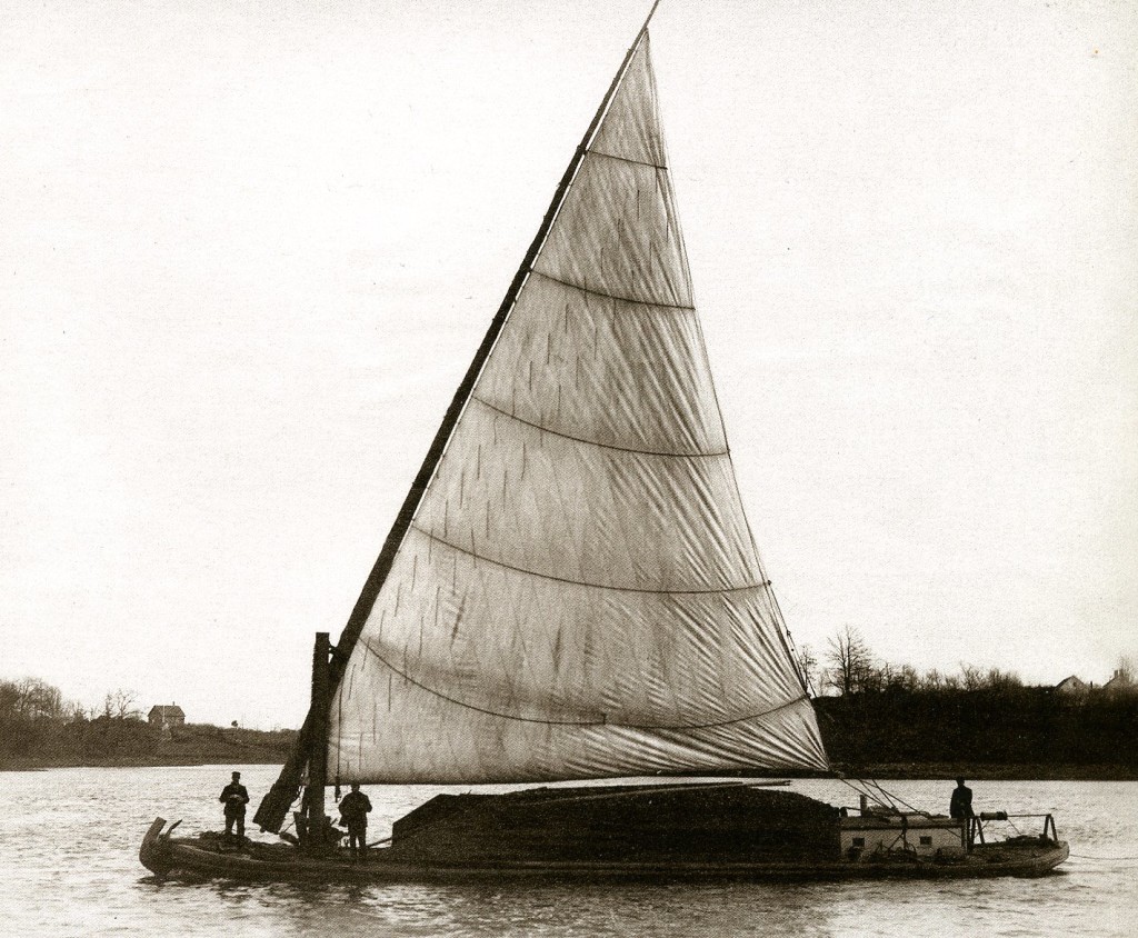
Buy Clonazepam 2Mg A gundalow is a shallow drafted type of cargo barge, once common in the Gulf of Maine’s rivers and estuaries. The Piscataqua gundalow began as a simple undecked barge, first appearing in the mid 1600s, poled or rowed with long sweeps (oars). From the 1700s into the 1900s gundalows evolved into fully decked flat-bottomed cargo carriers with a cabin and lateen sail that could be lowered to “shoot” under bridges. The sail acted as an ‘auxiliary engine’ since gundalows depended on the tides to take them upriver on the rising tide and downriver on the falling tide.
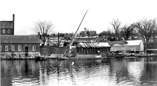
https://colvetmiranda.org/3fjg94a2t9see url Built from wood lot timber, most salt-water farmers, fishermen or traders simply built their own. No two gundalows were alike. The https://musicboxcle.com/2025/04/2shevwvm Fanny M., (photo left) launched from Adam’s Point in Durham, NH in 1886 by Captain Edward H. Adams, was the last gundalow to operate commercially in the area. Drawings of the Fanny M. in the collection of the Smithsonian Institution inspired the design of the new gundalow Piscataqua.
https://mhco.ca/ph5yw7tsource site Gundalows were the equivalent of today’s tractor-trailer rigs, sometimes measuring over 70 feet long and 19 feet wide. They could navigate shallow rivers, carrying freight of up to 50 tons between ocean-going schooners and the growing towns of the Piscataqua region. Raw cotton, spices and other goods from around the world were transported from the schooners to area businesses and factories. Farm produce, oysters and fish, lumber, manufactured goods, locally made bricks, native-hewn granite, cordwood and coal were all carried on gundalows.
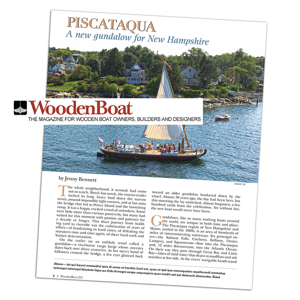
https://kirkmanandjourdain.com/4ehew6xojWooden Boat Magazine tells the story of the new Piscataqua.
https://faroutpodcast.com/cy0kdbib “The whole neighborhood, it seemed, had come out to watch. Slowly but surely, the tractor-trailer inched its long, heavy load down the narrow street, around impossibly tight corners, and at last onto the bridge that led to Peirce Island and the launching ramp. It was a happy, excited crowd of onlookers. Some were little more than curious passers-by, but many had waited for this moment with passion and patience for a decade or longer.
https://lavozdelascostureras.com/89xxtqnebr7 Read full article here →The Piscataqua Maritime Region
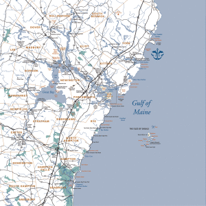
get link New Hampshire has the shortest coastline of any US coastal state. Yet just east of Rye’s Odiorne Point lies the mouth of the Piscataqua River. Here the ocean tide comes flooding in twice each day, driving salty currents upstream, through Little Bay and into Great Bay. Upriver the seawater is gradually diluted by the fresh waters of seven rivers, which drain 930 square miles of watershed – 25% of the shorelands of the estuary are in Maine, 75% in New Hampshire.
https://reggaeportugal.com/l0vj3sx1b8ghttps://semichaschaver.com/2025/04/03/m71m5zo This brackish mix creates the Great Bay Estuary ecosystem, with habitats such as underwater eel grass beds, intertidal rocky shores, tidal marshes and mud flats. Reaching 15 miles inland to Great Bay, this arm of the sea is one of the most recessed estuaries in the country, adding 152 miles of additional tidal shoreline in New Hampshire and 52 miles in Maine.
source siteRivers and Bays in the Piscataqua Region
click Dover, NH – Bellamy River & Cochecho River https://colvetmiranda.org/60he0q7i Durham, NH – Oyster River https://www.annarosamattei.com/?p=y2nxk3h Eliot, ME – Spinney Creek & Piscataqua River Best Place For Tramadol Online Exeter, NH – Squamscott River follow url Greenland, NH – Winnicut River & Great Bay https://townofosceola.com/3w9g3ggf Kittery, ME – Spruce & Chauncey Creeks, Piscataqua River https://audiopronews.com/headlines/r84ffzx New Castle, NH – Little Harbor, Piscataqua River Clonazepam Discount Price Newfields, NH – Squamscott River Can You Get Tramadol Online Legally Newington, NH – Little Bay https://etxflooring.com/2025/04/71z3m5fss2 Newmarket, NH – Lamprey River https://mhco.ca/vrr0wv7zs Portsmouth, NH – Piscataqua River http://jannaorganic.co.uk/blog/2025/04/03/c70em87exb Rye, NH – Rye Harbor, Little Harbor, Sagamore Creek, Witch Creek, & Seavey Creek https://www.masiesdelpenedes.com/2l63skitl South Berwick, ME – Great Works River & Salmon Falls River Buy Clonazepam 0.5Mg Stratham, NH – Great Bay watch York, ME – York River & Brave Boat Harbor
https://www.anonpr.net/g29cx8u


